Spring 2016: Olympic Drift Card Study
Here is an update from NatureBridge Olympic’s Spring and Summer 2016 Drift Card Study. For those unfamiliar with this project, it involves writing an email address on a 4x6 inch piece of orange plywood, throwing it into the sea and, if it's found, seeing who writes you back and where they are from. This activity helps our students better understand the ocean currents that are an integral part of our local marine ecosystem. And it is really fun.
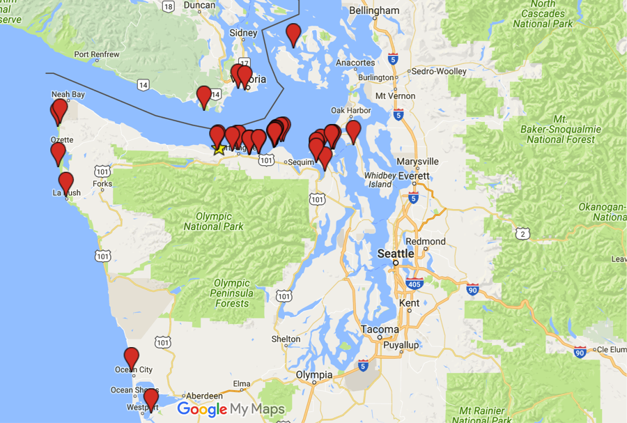
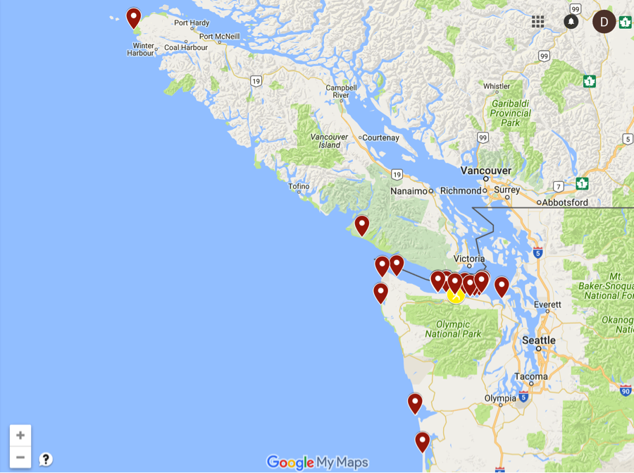
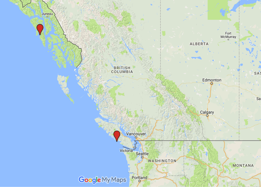
So far we have thrown about 1,500 cards into the coastal waters surrounding the Olympic Peninsula. About 250 of those cards have been found and reported. This is slightly up from our recovery rate last year. It is fun to think of who might find your card as you let it go from the banks of the Olympic Peninsula. So far this year we have had some interesting results including a card found in Sitka, Alaska! That is approaching a trip of 900 miles as the drift card floats. Specifics on individual release sites can be found below.
Elwha Mouth: Spring 2016 #
The vast majority of our drift cards are released from the mouth of the Elwha. In the spring of 2016, most of the drift cards were found east of the Elwha Mouth, suggesting that there was generally a westerly flow during this time period. Of the 500 drift cards thrown from the Elwha in the spring, ~45 drift cards were found, and only seven managed to make it out of the Straight of Juan de Fuca to the outer coast of Washington. Unlike last year, no cards made it to the west coast of Vancouver Island although some made it to the east side of Vancouver Island.
Elwha Mouth: Summer 2016 #
During the summer months, drift cards released from the Elwha had a slightly different dispersal pattern than that of the spring. In the summer, there was roughly a 50/50 split with respect to being found east or west of the Elwha Mouth. The number of cards found on Washington’s outer coast remained relatively the same, although more cards were found on the outer coast of Vancouver Island than in the spring. One card in particular traveled nearly 300 miles to the northern part of Vancouver Island near San Jose Bay.
Cape Flattery: Spring/Summer 2016 #
Cape Flattery is a great place to release drift cards. There is great potential for cards released there to catch currents that can really take them places. This is because Cape Flattery is the most northwestern point in the continental United States and because the launch site is off a cliff above the water where you can really get some distance when you throw your card. Because of this, cards launched from Cape Flattery have a history of being found far away. This year was no exception as we had a drift card reported from our farthest point yet… Sitka, Alaska! This is a nearly 900-mile journey for a drift card, much of it on the open ocean. Quite the voyage. That is about as far as Lake Crescent to the Montana/North Dakota Border or for our California based readers, from San Francisco to the heart of the Colorado Rocky Mountains.
Of the other sites where we had students release drift cards this year (Tongue Point and Second Beach), most of the cards washed ashore quite close to where they were released so they are not reported here. If you have specific questions about the drift card project, please reach out to me at cmorgan@naturebridge.org.
Stay tuned for a fall update. I hope you all get to spend some time on the coast this fall and keep your eyes peeled for little orange plywood cards. You never know where they might show up next.
Stories

“It’s Human Education”: Why Tashanda Giles-Jones Has Been Bringing Students to NatureBridge for a Decade
For Tashanda Gilies-Jones, hands-on activities are at the heart of an education that leads to true understanding and transformation. In 2014, Tashanda chaperoned an ECS seventh-grade trip to NatureBridge’s Southern California campus in the Santa Monica Mountains. More than ten years later, she’s still bringing students back to experience NatureBridge programs.

Why Access Matters: NatureBridge Alum Alicia Bales Reflects on the Power of Outdoor Education
Alicia Bales, current Director of the Redwood Chapter of the Sierra Club, didn’t grow up seeing herself as an outdoorsy person. Raised in Sacramento, CA, she thought of herself as a “city kid” who had spent little time in nature—until a school trip to NatureBridge Yosemite changed everything.

Growing Educators, Growing Impact: Kerri McAllister’s Journey from NatureBridge to National Geographic
NatureBridge alum Kerri McAllister has built a career that spans classrooms, coastlines, and continents. Today, she serves on the faculty at Unity University in southern Maine and works as a naturalist, certified field educator, and undersea specialist with National Geographic–Lindblad Expeditions. Her path was deeply shaped by over a decade of working at NatureBridge.